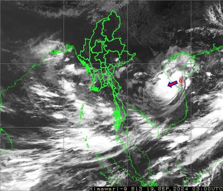
19 September 2024
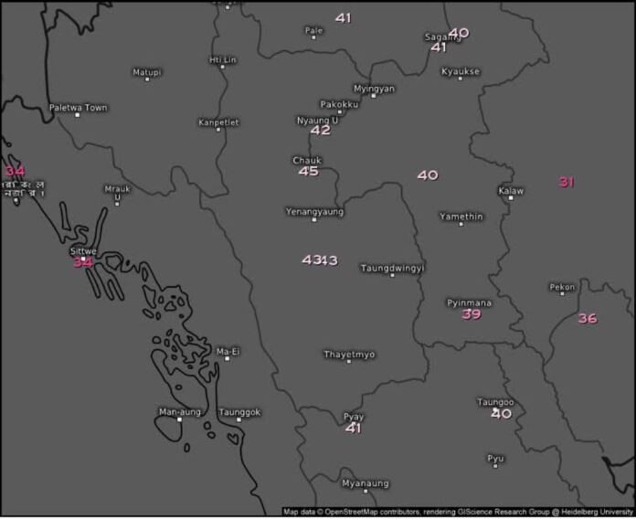
The Department of Meteorology and Hydrology has announced that the tropical depression forming in the South China Sea may become stronger and may start crossing the southeastern regions of Myanmar on September 20.
Residual clouds and whirlwinds of tropical storm “SOULIK” will begin to cross the southeastern regions of Myanmar and may continue to move west and southwest. It may re-strengthen as a low pressure area over the Kapali Sea and Bay of Bengal. Due to the speed of the cyclone that may pass through, between September 20 and 25, Nay Pyi Taw, Mandalay Region, Magway Region, Bago Region, Yangon Region, Ayeyarwady Region, Tanintharyi Region, Shan State, Chin State, Rakhine State, Kayah State, Karen State, and Mon State, there may be localized heavy rain and strong winds in some areas.
According to the newly released data from the Joint Typhoon Warning Center (JTWC), TD-SIXTEEN will reach tropical storm TS status at around 6:30 PM on September 19th, with sustained winds of 40 knots (46 miles per hour) near the center. #SouthChinaSea #Tropical Depression #mtnews #mtnewsupdate